Genetic History of Georgia
In this interdisciplinary study, we are analyzing of genetic diversity in Georgia to elucidate the population history of the Caucasus and Eurasia. Through fieldwork in the region, we obtain genealogical data, oral histories and DNA samples from individuals living in different regions of the country. To date, they include Svaneti, Samegrelo, Guria, Adjara and Samtskhe-Javakheti. For the DNA samples, we are analyzing mtDNA, Y-chromosome and autosomal variation through genotyping and genomic sequencing. The resulting data are compared to those for other populations of the Caucasus, West Asia and Europe and integrated with archeological, ethnological, and linguistic evidence to better situate the Caucasus and its peoples in the history of the peopling of Eurasia.
Using this approach, we are exploring questions concerning the population history of the Caucasus. What was the pattern of human settlement of the Caucasus during the Upper Paleolithic, Mesolithic and Neolithic and Bronze Ages? To what extent did populations originating in the Caucasus genetically influence other populations during the human settlement of Eurasia? What was the biological and cultural impact of the Neolithic spread of agriculture into the Caucasus? How are distinctive are the genetic histories of North and South Caucasus populations? Can we see any overlap in the archaeological and genetic histories of western versus eastern Georgia?
In what follows, we present the results of our research efforts in Georgia over the past 12 years. They include photographs from fieldwork, maps from the region, genetic data, archaeological materials, and historical documents.
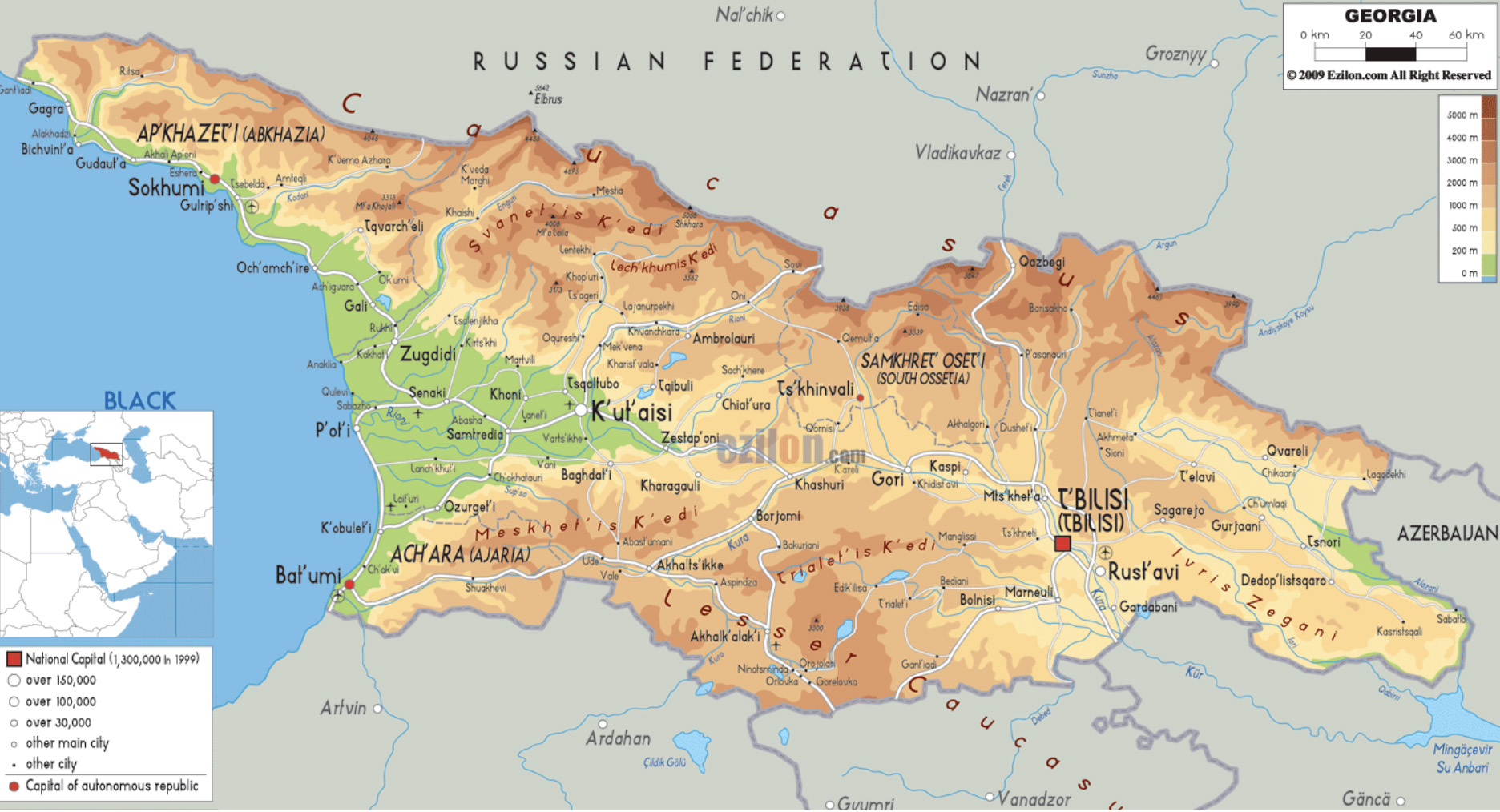
Topographic Map of Georgia
The topographic map of Georgia showing major landscape features like elevations, mountain ranges, seas, lakes, plateaus, peninsulas, rivers, plains, landforms and other topographic features. Source: https://www.ezilon.com/maps/europe/georgia-physical-maps.html
Administrative Map of Georgia
An administrative map of the country of Georgia (http://www.mappery.com/map-of Georgia-Administrative-Map). The key in the upper right corner provides details about the provinces within the country.
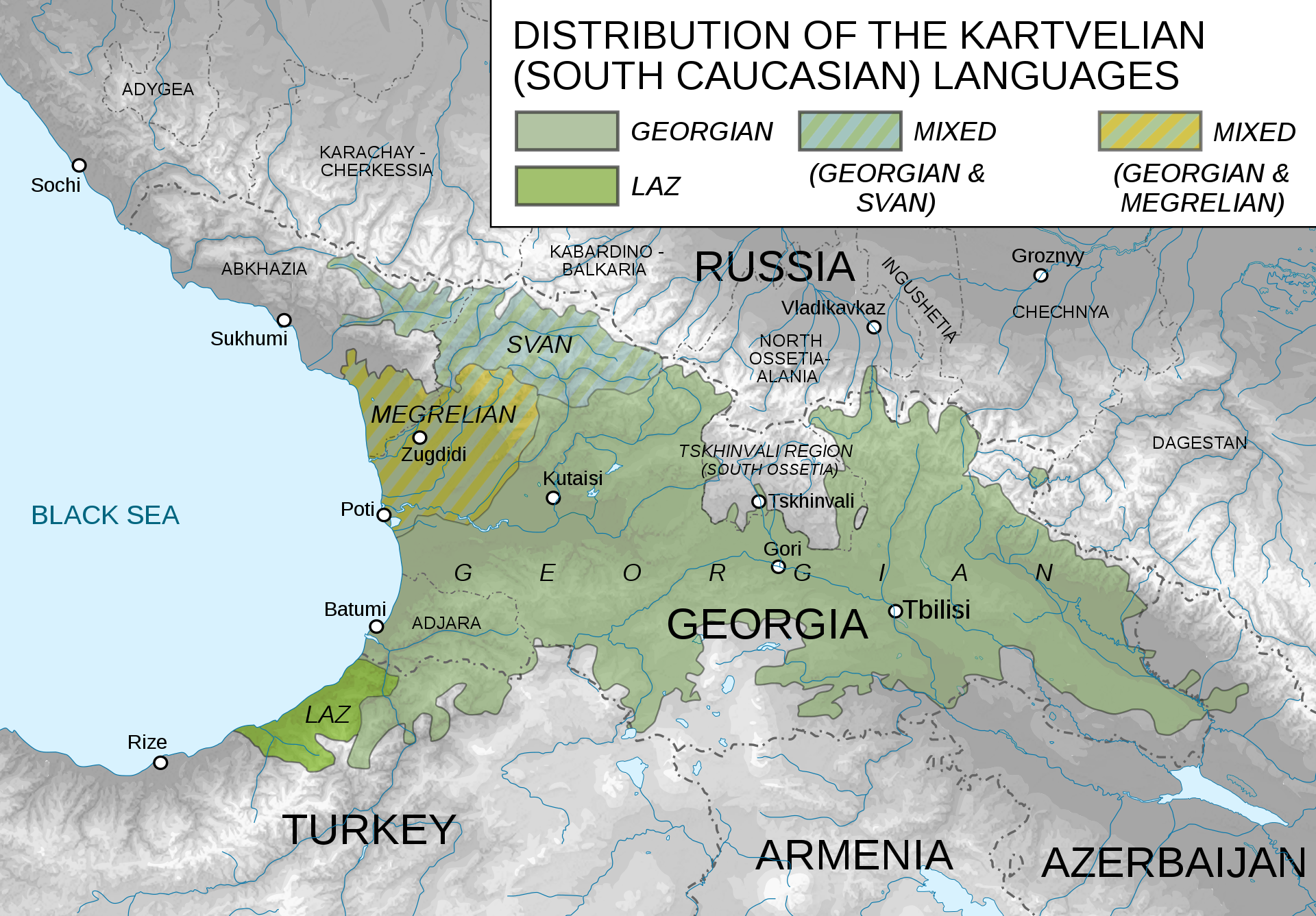
Linguistic Map of Georgia
This map shows the historical distribution of the four languages within the Kartvelian language family, which are today only spoken in Georgia.
Source: https://en.wikipedia.org/wiki/Georgian_language
Fieldwork
Over the past dozen years, we have conducted research in five regions of western Georgia, including Svaneti and Mingrelia (Samegrelo), Guria, Adjara and Samtskhe-Javakheti. In the associated pages, we describe the anthropological genetics work completed in each region and explore the implications of our findings for the history of Georgia and the Caucasus more broadly.
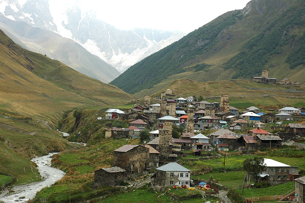
Svaneti
Village of Ushguli in Svaneti. Photo credit: T.G. Schurr
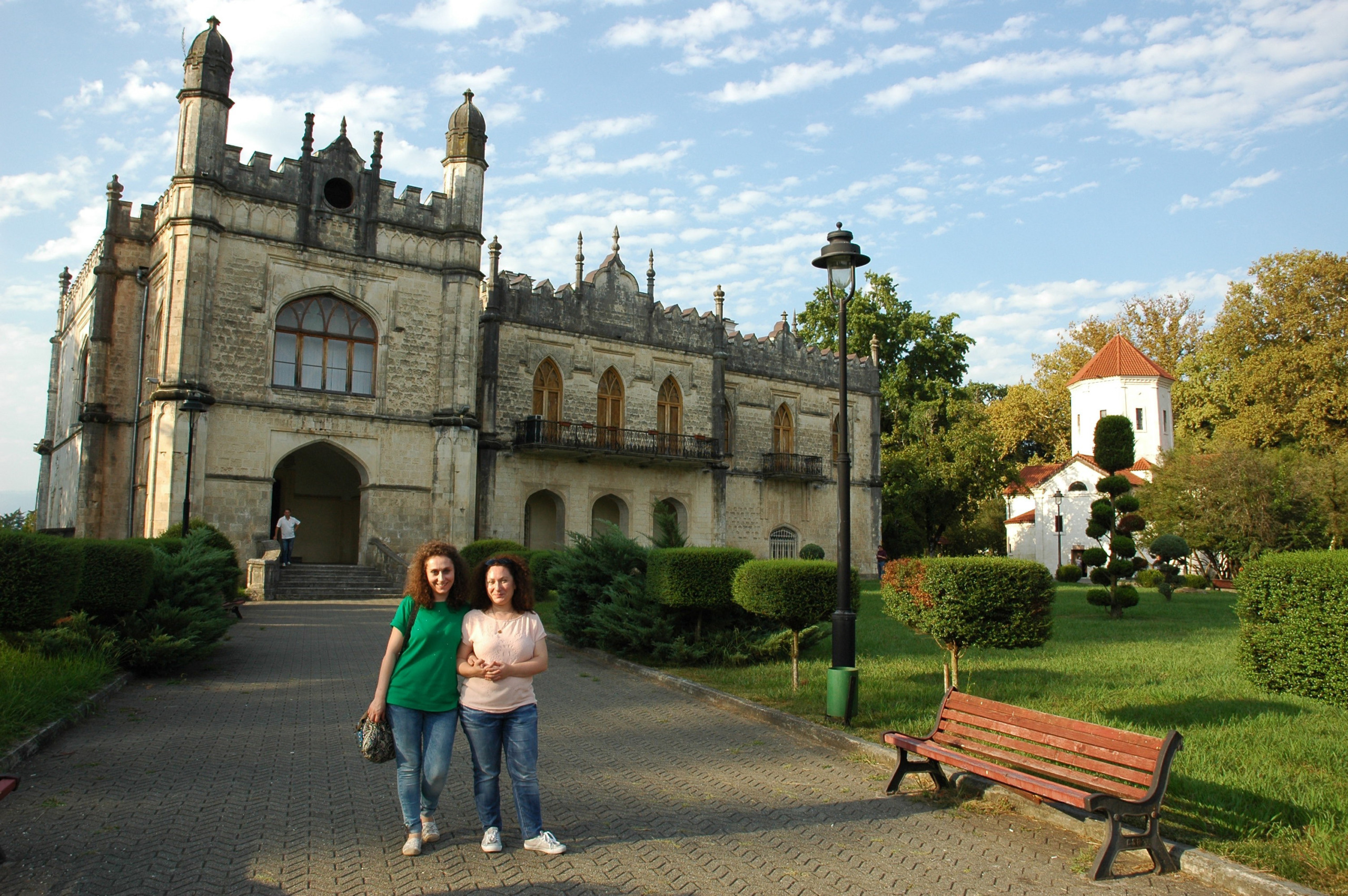
Mingrelia (Samegrelo)
Laliashvili Sisters in front of the Dadiani Palace in Zugdidi, Samegrelo. Photo credit: T.G. Schurr

Guria
The interior of the Georgia Orthodox church at Jurukveti. Photo credit: T.G. Schurr
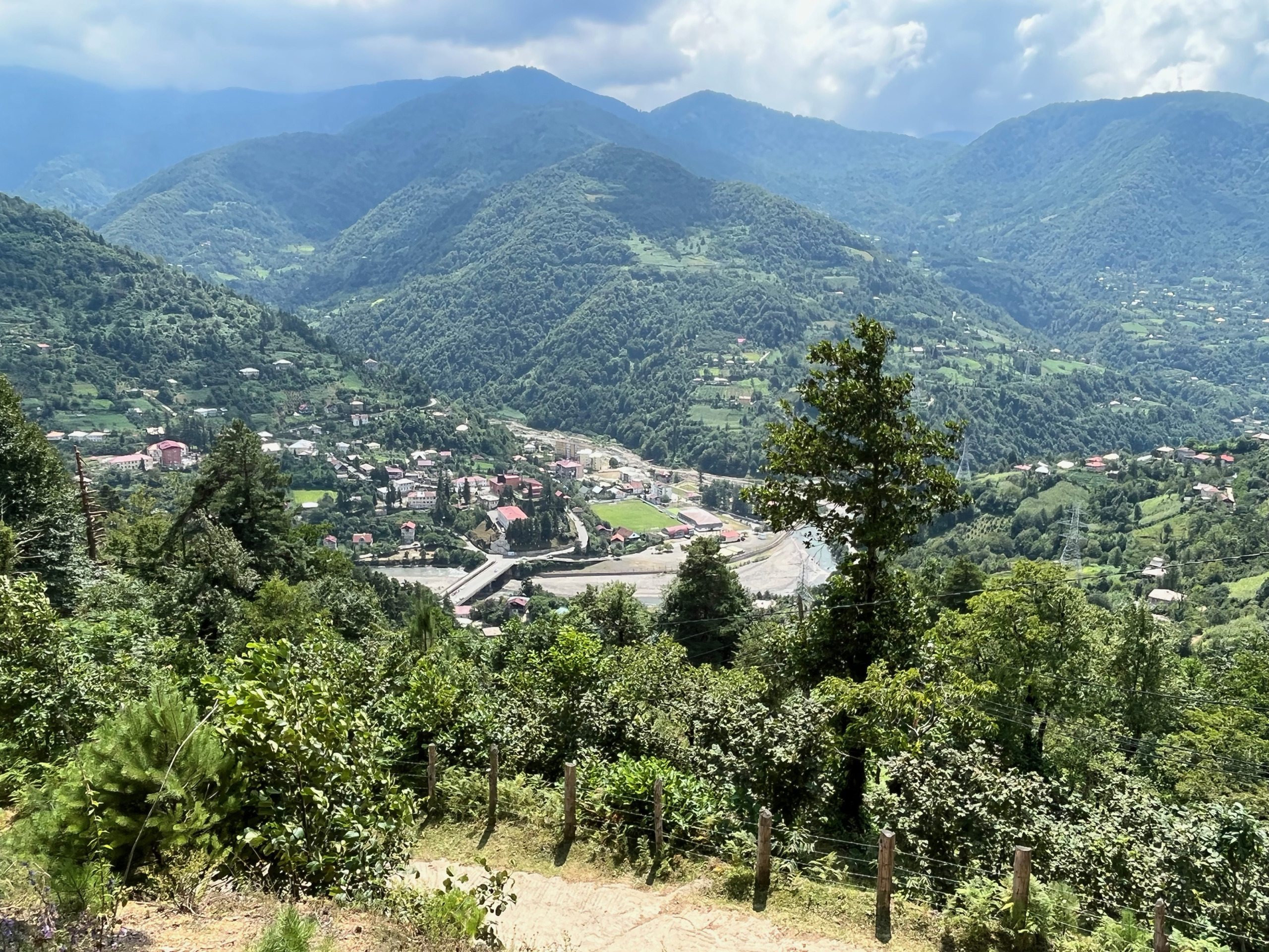
Adjara
A view of the Acharistskali River from the village of Gubeti. Photo credit: T.G. Schurr
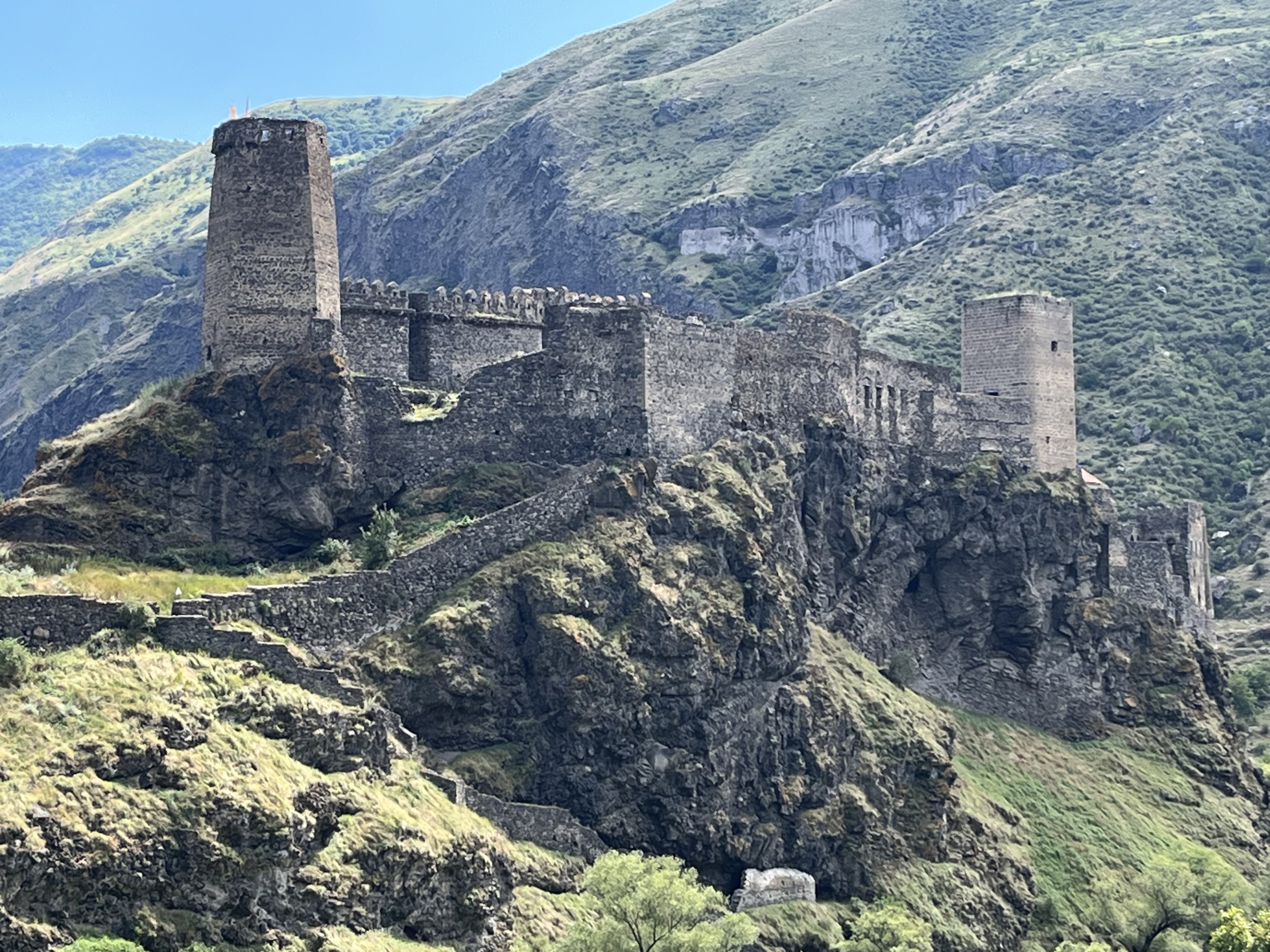
Samtskhe-Javakheti
Khertvisi Fortress. Photo credit: T.G. Schurr
Publications
Yardumian A, Schurr TG. 2024. The Peopling of the Caucasus: Early Human Settlement at the Crossroads of Continents. Cambridge: Cambridge University Press (In press).
Schurr TG, Shengelia R, Shamoon-Pour M, Chitanava D, Laliashvili S, Laliashvili I, Kibret R. Kume-Kangolo Y, Akhvlediani I, Mathieson I, Yardumian A. 2023. Genetic analysis of Mingrelians reveals long-term continuity of populations in western Georgia (Caucasus). Genome Biol Evol 15(11):evad198. Link
Chitanava D, Schurr TG, Bitadze L Khorava B, Tsimintia Q, Shengelia I, Yardumian A, Lalishvili S, Shengelia R. 2019. An interdisciplinary analysis of surname extinction in Samegrelo (North-West Georgia). J Georgian Acad Sci 13(4): 109-114.
Yardumian A, Schurr TG, Shengelia R, Chitanava D, Laliashvili S, Bitadze L, Laliahsvili I. 2017. Ancient lineages: Reconstructing the genetic history of Svaneti, northwest Georgia. Expedition Magazine 59(1): 8-17 (Spring)
Yardumian A, Schurr TG. 2017. The deep history of the Caucasus is beginning to be revealed through genetic sequencing. Science Trends DOI:10.31988/SciTrends.6880.
Yardumian A, Shengelia R, Bitadze L, Chitanava D, Laliashvili S, Laliashvili I, Villanea F, Sanders A, Azzam A, Groner V, Edleson K, Vilar MG, Schurr TG. 2017. Genetic diversity in Svaneti and its implications for the human settlement of the highland Caucasus. Am J Phys Anthropol 164(4):837-852. Link
Schurr TG, Yardumian A, Shengelia R, Bitadze L, Chitanava D, Laliashvili S, Laliashvili I, Sanders A, Azzam A, Groner V, Edleson K, Vilar M. 2015. Genetic diversity and population history in Svaneti, northwestern Georgia. Caucasiologic Papers 7:319-336.
Laboratory of Molecular Anthropology
University of Pennsylvania
421 University Museum
3260 South Street
Philadelphia, PA 19104-6398, USA
Tel: 215-573-2656

FOLOW US:
